


Carte SD Lacs Suisses BlueChart G3
Tu as des questions sur le produit?
Vers le formulaire de demandeGARMIN - Carte SD Lacs Suisses BlueChart G3
- Provides exceptional coverage, clarity and detail with coastal charts that feature integrated Garmin and Navionics® data
- Auto Guidance¹ technology calculates a route using your desired depth and overhead clearance and provides a suggested path to follow
- Includes depth range shading for up to 10 depth ranges, enabling you to view your target depth at a glance
- Up to 1’ contours provide a more accurate depiction of the bottom structure for improved fishing charts and navigation in swamps, canals and marinas
Experience unparalleled coverage and brilliant detail when you’re on the water with charts that feature integrated Navionics® data, Auto Guidance technology¹ and more.
Auto Guidance Technology
Whether you are fishing or cruising, select a spot, and get a route showing you the general path and nearby obstructions at a safe depth1.
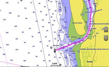
Depth Range Shading
This feature displays high-resolution depth range shading for up to 10 depth ranges so you can view your designated target depth.
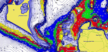
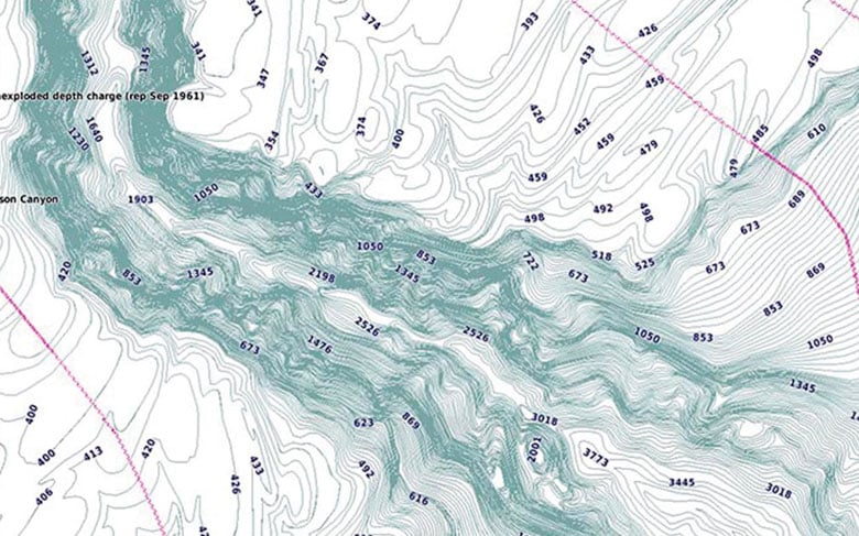
Detailed Contours
BlueChart g3 charts feature 1’ contours that provide a more accurate depiction of bottom structure for improved fishing charts and enhanced detail in swamps, canals and port plans.
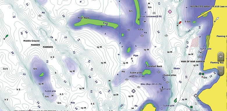
Shallow Water Shading
To aid in navigation, Shallow Water Shading allows map shading at a user-defined depth to give a clear picture of shallow waters.
¹Auto Guidance is for planning purposes only and does not replace safe navigation practices. Auto Guidance is not included in preloaded BlueChart g3 for ECHOMAP™ Plus series chartplotters
Cover:
Covers the lakes and rivers of the Alpine region of Europe. Coverage includes Lakes Constance (Upper, Lower and Seerhein), Zurich, Lucerne, Geneva, Thun, Brienz, Annecy, Bourget, d'Aiguebelette, Neuchatal, Maggiore, Orta, Como, Iseo, Lugano, Garda, Biel and Neusiedl/Ferto. Rivers include the Rhine from it's headwaters to Germersheim, the Danube from it's headwaters to Bratislava, the Necklar from it's headwaters to Offenau and the Main-Danube Canal from Hilpoltein to the Danube. Other rivers include the Isar, the Inn, the Salzach and the Lech in their entireties.
La marque GARMIN est une entreprise américano-suisse dont le siège est à Schaffhouse et dont le centre opérationnel principal se trouve aux États-Unis, au Kansas. GARMIN fabrique entre autres des produits de navigation. En outre, GARMIN propose également des équipements pour les bateaux - également combinés avec un sondeur. La particularité des appareils GARMIN est qu'ils peuvent être connectés à un ordinateur via Bluetooth ou USB, ce qui permet d'évaluer facilement les trajets enregistrés par la suite.
plus de GARMINLivraison standard
livraison sous 3 à 5 jours ouvrés
Livraison express
La livraison express n'est pas disponible pour cet article.